


Description
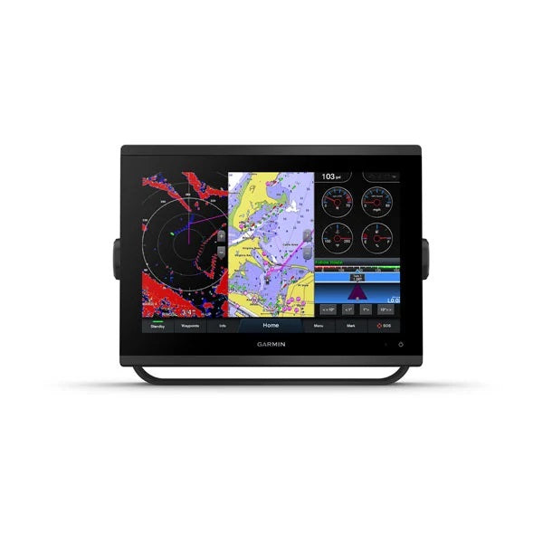
Garmin GPSMAP 1243 Chartplotter with Garmin Navionics+ coastal and inland water charts for the U.S. and Canada
Model: 010-02367-60
New high-resolution in-plane switching touchscreen display offers improved sunlight readability and wide-angle visibility over previous-generation 12″ units
Fast and responsive, this robust GPSMAP® system references 10 Hz GNSS (GPS, GLONASS and Galileo) for accurate positioning and smooth speed as well as COG data
Slimline display borders, edge-to-edge glass and reduced unit footprint make for easy retrofit in a wider range of dash configurations
Preloaded Garmin Navionics+™ coastal charts and inland mapping feature Auto Guidance+™ technology (Auto Guidance+ is for planning purposes only and does not replace safe navigation operations) ; plus, there’s support for optional Garmin Navionics Vision+™ premium map content.
Built-in Garmin SailAssist™ features, including laylines, race features, set and drift, wind data and more. Requires compatible wind transducer (sold separately)
J1939 engine connectivity for easy integration with engines and our exclusive OneHelm™ feature for connecting to your compatible third-party devices, such as EmpirBus™ digital switching
Easily build your marine system — from compatible sonar and autopilots to compatible radar, cameras and multimedia — by using NMEA 2000® and NMEA 0183 networking and the Garmin Marine Network
Use built-in Wi-Fi® networking to pair with the free ActiveCaptain® smartphone app for access to the OneChart™ feature, smart notifications, software updates and more.
Integrated ANT® connectivity support for use with compatible quatix® smartwatches, the gWind™ Wireless 2 transducer, GNX™ Wind marine instrument and wireless remote controls (sold separately)””
“”Get a sharper view from your connected helm with the GPSMAP® 1243 chartplotter. Its high-resolution 12″ in-plane switching touchscreen and ultrasleek design seamlessly integrate into your Garmin marine system, putting full control at your fingertips. Preloaded Garmin Navionics+™ coastal charts and inland mapping feature Auto Guidance+™ technology (Auto Guidance+ is for planning purposes only and does not replace safe navigation operations) for helping you get where you need to go. Plus, there’s support for optional Garmin Navionics Vision+™ premium map content. Easily build your marine system — from compatible sonar and autopilots to compatible radar, cameras and multimedia — by using HTML 5.0, NMEA 2000® and NMEA 0183 networking, J1939 for engines and the Garmin Marine Network. Add FrontVü™ forward-looking sonar (sold separately) (The ability to effectively avoid forward collisions with FrontVü sonar decreases as speed rises above 8 knots[HT1] ) which can help in avoiding underwater obstructions ahead. Or pair your plotter with your other compatible Garmin devices, such as quatix® smartwatches, wind transducers, wireless remote controls and more.””
Specifications
General
PHYSICAL DIMENSIONS
12.1″ x 8.9″ x 3.2″ (30.8 x 22.8 x 8.2 cm)
DISPLAY SIZE
10.3″” x 6.4″”; 12.1″” diagonal
DISPLAY RESOLUTION
1280 x 800 pixels
DISPLAY TYPE
WXGA display
WEIGHT
6.6 lbs. (3.0 kg)
WATER RATING
IPX7
POLARIZED SUPPORT
Yes
POWER CONSUMPTION
Max power usage at 10 Vdc: 26.5 W
Typical current draw at 12 Vdc: 1.7 A
Max current draw at 12 Vdc: 2.2 A
ANTENNA
Internal or external over NMEA 2000
MOUNTING OPTIONS
Bail, flush or flat
RECEIVER
10 Hz high-sensitivity
GARMIN MARINE NETWORK™ PORTS
2
Maps & Memory
PRELOADED MAPS
Garmin Navionics+ coastal and inland water charts for the U.S. and Canada
ACCEPTS DATA CARDS
2 microSD™ cards (back of unit)
WAYPOINTS
5,000
TRACK LOG
50,000 points; 50 saved tracks
ROUTES
100
Outdoor Recreation
TIDE TABLES
Yes
Chartplotter Features
GARMIN RADAR COMPATIBLE
Yes
GARMIN SONAR COMPATIBLE
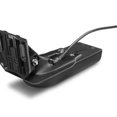
Yes (with external black box, sold separately)
GARMIN SMARTMODE COMPATIBLE (CUSTOMIZABLE MONITOR PRESETS)
Yes
SUPPORTS AIS (TRACKS TARGET SHIPS POSITION)
Yes
SUPPORTS DSC (DISPLAYS POSITION DATA FROM DSC-CAPABLE VHF RADIO)
Yes
SUPPORTS FUSION-LINK™ COMPATIBLE RADIOS
Yes
GSD™ BLACK BOX SONAR SUPPORT
Yes
GCV™ BLACK BOX SONAR SUPPORT
Yes
ACTIVECAPTAIN COMPATIBLE
Yes
GRID™ (GARMIN REMOTE INPUT DEVICE) COMPATIBLE
Yes
WIRELESS REMOTE COMPATIBLE
Yes
SAILING FEATURES
Yes
Sonar Features & Specifications
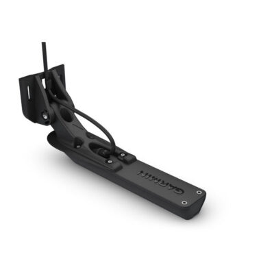
DUAL-FREQUENCY (50/200 KHZ) SONAR CAPABLE
Yes (with external black box, sold separately)
DUAL-BEAM (77/200 KHZ) SONAR CAPABLE
Yes (with external black box, sold separately)
CHIRP SONAR TECHNOLOGY
Yes (with external black box, sold separately)
CLEARVü
Yes (with external black box, sold separately)
SIDEVü
Yes (with external black box, sold separately)
Connections
NMEA 2000® COMPATIBLE
Yes
NMEA 0183 INPUT PORTS
1
NMEA 0183 OUTPUT PORTS
1
VIDEO INPUT PORTS
1 BNC
VIDEO OUTPUT PORTS
1 HDMI
WIRELESS CONNECTIVITY
Yes
J1939 COMPATIBLE
Yes
What’s in the Box:
GPSMAP 1243 chartplotter with Garmin Navionics+ coastal and inland water charts for the U.S. and Canada
microSD™ card preinstalled
Power cable
NMEA 2000® T-connector
NMEA 2000 drop cable (2 meters)
Bail mount kit with knobs
Flush mount kit with gasket
Protective cover
Trim piece snap covers
Documentation
Reviews
There are no reviews yet.